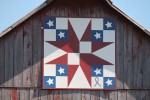
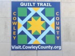
Barn Quilt Trail
Barn Quilt Trail
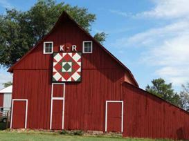
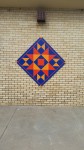
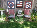
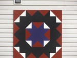
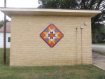
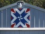
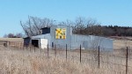
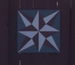
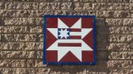
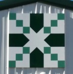
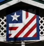
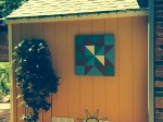
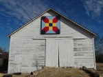
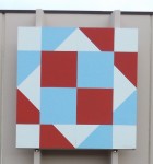
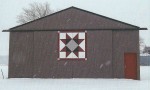
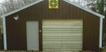
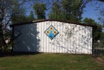
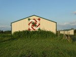
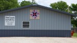
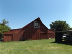
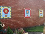
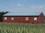
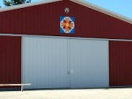
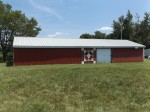
Brightly colored barn quilts are starting to appear across the scenic countryside of Cowley and neighboring counties. Cowley County is one of twenty-two counties participating in the Kansas Flint Hills Quilt Trail; a trail formed to celebrate agricultural heritage, promote rural pride and attract visitors to the area.
The “Barn Quilt Movement” started in Ohio when a daughter wanted to honor her mother and her Appalachian heritage by having a painted quilt hung on her barn in Adams County, Ohio. This simple idea has spread to over 48 states and to Canada with over 7000 quilts participating in the organized American Quilt Trail, which includes the Kansas Flint Hills Quilt Trail and Cowley County.
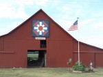
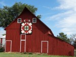
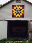
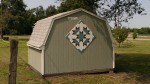
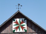
Over 100 Barn Quilts now grace Cowley County! Here are the links for printable and Google Map for your convenience:
- Cowley County Barn Quilt Trail Printable Map
- Cowley County Quilt Trail Google Map
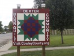
- Dexter Barn Quilt Trail Printable Map
- Dexter Barn Quilt Trail Map
Visit the Kansas Flint Hills Quilt Trail website to view the barn quilts from all 22 neighboring counties. For more information on the barn quilt trail and how to participate, please send email to cowleyfirst@cowleycountyks.gov.
Follow us to get most updated information!


The Cowley County Tourism Alliance often hosts barn quilt classes throughout the county. For information on upcoming classes or the Cowley County Barn Quilt Trail, contact barn quilt representatives at the Arkansas City Chamber or Winfield Chamber at (620) 221-2420 or 442-0230 or Cowley First at 221-9951 or 442-3094 or email cowleyfirst@cowleycountyks.gov for information.
How to Make a Barn Quilt
We are often asked about how to make a barn quilt. Visit the Kansas Flint Hills Quilt Trail website. Both a video presentation and a step by step guide is on their site or contact a barn quilt representative at one of the phone numbers listed above for assistance.
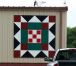
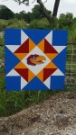
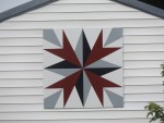
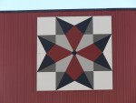
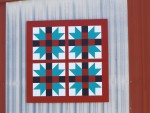
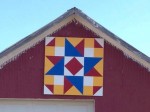
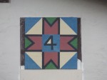
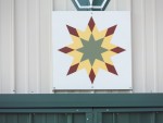
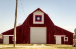
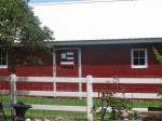
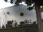
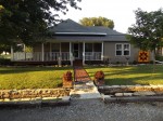
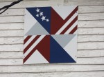
Check out the latest barn quilts in Cowley County.
– Safety & Respecting Private Property –
Please be respectful, responsible, and careful while viewing and enjoying the Quilt Trail. Please use caution when slowing near a site. Stopping along busy roads can be dangerous and illegal. Most quilt blocks are located on private property and should be viewed from the public road unless otherwise indicated at the site, or on this website. If it is a business, or a park it is generally open to the public.
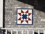
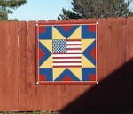
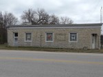
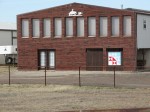
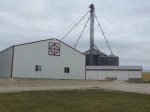
100+ Locations in Cowley County and Growing!
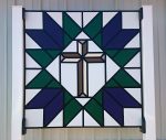 | “Cross and Tulips” New Hope Fellowship Church 19195 61st. Rd. Winfield, KS 67156 Artist: The Sisters’ Bible Study Group GPS Coordinates: 37.212932200, -97.041535900 |
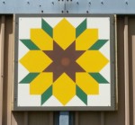
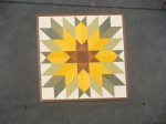
 | “Wildcat Sunflower” Douglas and Amy Lawson 9233 264th RD, Arkansas City, KS 67005 Artist: Amy Lawson GPS Coordinates: 37.096147, -97.000181 |
 | “The Sunflower” Troy and Morea Simmons 8943 111th Road, Winfield, KS 67156 Artist: Donna Martin GPS Coordinates: |
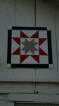
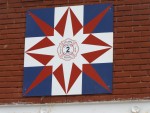
 | “Harvest Star” SKT 415 Main St., Atlanta, KS 67008 Artist: Elaine Webb GPS Coordinates: 37.435235, -96.769529 |
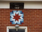
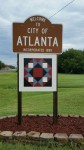 | “Ohio Star Variation” Atlanta Welcome Sign South 602 S Main, Atlanta, KS 67008 GPS Coordinates: 37.432581, -96.769085 |
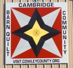
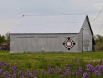
 | “Log Cabin” Cambridge Cabin 8610 281st Rd, Cambridge, KS 67023 Artist: Deb Firebaugh GPS Coordinates: 37.36583, -96.658975 |
 | “Stars and Stripes” Bob Hobart 415 W Third, Burden, KS 67019 Artist: Bob Hobart, Sheila Reams, Brenda Thompson GPS Coordinates: 37.313455, -96.758183 |
 | “Ohio Star Variation” Atlanta Welcome Sign North 101 N Main, Atlanta, KS 67008 GPS Coordinates: 37.439220, -96.769608 |
 | “Sunflower” Ernie and Marie Tackett 21158 Curtis Ave., Winfield, KS 67156 (view from 85th Rd/Cowley 27) Artist: Marie Tackett GPS Coordinates: 37.184416, -96.995845 |
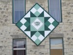
 | “Members Choice” K&O Steam & Gas Association 7441 162nd Rd, Winfield, KS 67156 Artist: K&O Steam Gas Association Members GPS Coordinates: 37.245425, -97.033725 |
 | “Star Within a Star” Elaine Weathers 14450 US Hwy 77, Winfield, KS 67156 Artist: Elaine Weathers GPS Coordinates: 37.282056, -97.006500 |
 | “Gathering Wheat” First Baptist Church 200 East 11th, Winfield, KS 67156 First Baptist Church Members GPS Coordinates: 37.238312, -96.995494 |
 | “Nickels Pinwheels” John and Karen Nickel 1910 W 14th, Winfield, KS 67156 Artist: John and Karen Nickel GPS Coordinates: 37.234196, -97.017174 |
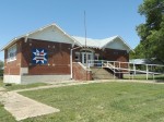
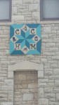 | “West Ward/Bryant” Cowley County Historical Society Museum 1011 Mansfield, Winfield KS 67156 Artist: Walt Nichols GPS Coordinates: 37.238793, -97.001075 |
 | “Plane” Strother Field Airport 22193 Tupper St, Strother Field Industrial Park, Winfield, KS 67156 Artist & Sponsor: Cowley First GPS Coordinates: 37.169642, -97.032493 |
 | “Friendship Star” Rocking F Ranch/Dorothy Fisher 31336 US Hwy 160, Cambridge, KS 67023 Artist: The Fishers GPS Coordinates: 37.323341, -96.595564 The barn quilt is located at the entrance of the Rocking F Ranch where the Fisher Family operates the Rocking F Cattle Company raising angus beef. |
 | “Firefighter Dream” Burden Fire Department 500 Chestnut, Burden, KS 67019 Artist & Sponsor: Cowley First GPS Coordinates: 37.316640, -96.754706 |
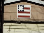
 | “Four X, Patriotic Flag, & Pieced Star” Richard and Sheryl Clower 1303 E. 7th Ave. Winfield, KS 67156 Artist: Sheryl Clower GPS Coordinates: 37.242642, -96.981561 |
 | “Kansas” Richard and Sheryl Clower 1303 E. 7th Ave. Winfield, KS 67156 Artist: Sheryl Clower GPS Coordinates: 37.242642, -96.981561 |
 | “Ohio” Richard and Sheryl Clower 1303 E. 7th Ave. Winfield, KS 67156 Artist: Sheryl Clower GPS Coordinates: 37.242642, -96.981561 |
 | “Dexter Community Quilt” City of Dexter, 208 N. Main, Dexter, KS, 67038 Artist: Dexter High School Students GPS Coordinates: 37.180388, -96.716055 |
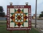 | “Dexter Community Quilt” City of Dexter, 208 N. Main, Dexter, KS, 67038 Artist: Dexter High School Students GPS Coordinates: 37.180388, -96.716055 |
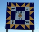
 | “Indian Star” Two Rivers Co-op, 300 S D St. Arkansas City, KS 67005 Artist: Udall FFA Members GPS Coordinates: 37.059152, -97.033990 |
 | “KU Star” Delbert Kemp, 25443 206th Rd. Dexter, KS 67038 Artists: Deb Firebaugh and Kerri Falletti GPS Coordinates: 37.181983, -96.706920 |
 | “Tennessee Compass” Richard and Kerri Koeppen, 102 Linden (View from Main St), Dexter, KS 67038 Artists: Dexter High School Students GPS Coordinates: 37.175956, -96.719699 |
 | “Carpenter Wheel” Dexter Housing, Inc., 215 S. Main, Dexter, KS 67038 Artists: Dexter High School Students GPS Coordinates: 37.177571, -96.718449 |
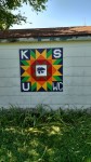
 | “Early Riser” Southern Kansas Telephone, 201 W. Main, Cambridge KS 67023 Artist: SKT Employees GPS Coordinates: 37.317154, -96.666405 |
 | “Fire Star” |
 | “Marine Star” |
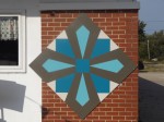
 | “Whirlpool” |
 | “Threads of Sunshine” |
 | “Broken Fan” |
 | “Farmer’s Daughter” |
 | “K U Denali” |
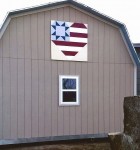
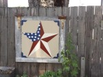
 | “Americana/Patriotic Star” |
 | “Rising Star” Arlan and Wilma Anglemeyer, 15060 U S Hwy 160, Winfield KS 67156 Artist: Deb Firebaugh A tornado destroyed their original home April 26, 1991. They soon rebuilt their present home at the same location. GPS Coordinates: 37.2 447 28, – 96.8 974 24 |
 | “K C Royal Crown” |
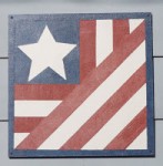
 | “Flag” |
 | “Blazing Star” |
 | “Crosses” |
 | “Flag” Iron Horse Vintage – Antiques – Linens @ Misc, 317 Main, Atlanta KS 67008 A unique shop filled with vintage objects, antiques, linens, kitchen wares and a variety of handmade items. Open by appointment, by chance or most Sundays in warmer weather. Call 620-394-2378 or 620-229-0042. GPS Coordinates: 37.4 3611 5, – 96.7 6947 5 |
 | “Fan” Iron Horse Vintage – Antiques – Linens @ Misc, 317 Main, Atlanta KS 67008 |
 | “Stepping Stones” Byron and Karen Carr, 507 Main, Atlanta KS 67008 Artist: Deb Firebaugh This block is located along Main Street on a recently constructed metal shop. GPS Coordinates: 37.4 345 76, – 96.7 693 09 |
 | “Flag” Dwain and Peggy Stout, 217 Main, Atlanta KS 67008 Over 130 years old, the house is one of the first homes built in Atlanta. View the quilt from 3rd Street. GPS Coordinates: 37.4 368 94, – 96.7 697 70 |
 | “Wilson Star” Wilson Family, 604 Omnia St, Atlanta KS 67008 Artist: Desiree Bryan This Wilson Family building was originally a blacksmith shop, and has had many purposes. GPS Coordinates: 37.4 356 99, – 96.7 687 51 |
 | “Star Within A Star Variation” |
 | “Sun Rays” |
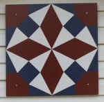
 | “Double Star” |
 | “Patriotic Flag” |
 | “Donna’s Fancy” |
 | “Double Tulip” |
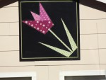 | “Tulip” |
 | “Cardinal” |
 | “Pieced Tulips” |
 | “Wisconsin Star” |
 | “American Star” |
 | “Laurel” |
 | “Bride’s Puzzle” |
 | “Railroad Crossing Quilt” |
 | “Hunters Star” |
 | “Crown of Thorns” Carl & Arlene Seeliger, 13618 161st Road, Burden KS 67019 The block is best seen when approaching the farm from the north, traveling south on 161st Road. Arlene had been asking for a barn quilt for some time. Carl presented the block, and had it mounted for her recent birthday. |
 | “Mount Rushmore” Jason and Kelly Kazban, 1410 N 3rd, Arkansas City KS 67005 Both retirees of the Air Force, Jason and Kelly relocated to Kansas and work for the county in emergency management and 911 dispatch. The barn quilt is displayed at their family home. GPS Coordinates: 37.07 8515, – 97.04 3524 |
 | “4M Star” Heritage Center – Massey Ministries, Margaret Massey 26798 212th Rd, Dexter KS 67038 The barn quilt is hung at the Heritage Center-Massey Ministries, also locally known as the Mark Massey Memorial Boys Ranch. What was originally the “Boys Ranch”, was founded in 1973 after the death of Bob and Margaret’s son, Mark, who was killed in an accident. The Massey’s organized the ranch to take in and raise boys needing a home. The property now houses the Heritage Center which offers lodging and a great room for family reunions, visiting hunters and local gatherings. GPS Coordinates: 37.172 599, – 96.684 392 |
 | “Harvest Star” Corey and Rachel Lampson, 27150 241st Rd, Dexter KS 67038 GPS Coordinates: 37.099 547, – 96.714 730 616 |
 | “Primitive Star” Dean and Lorraine Bailey, 17046 161st Rd, Winfield KS 67156 Artist: Donna Martin The barn quilt, hanging on the Bailey Morton building, can be seen from the intersection of US Hwy 160 and 161st Rd. GPS Coordinates: 37.440 625, – 97.006 616 |
 | “Hole In The Barn Door” Bill Larkin Farm, 15242 51st Rd, Winfield KS 67156 The Larkin barn was built in 1900 and has been in the family for 50 years. Bill & Marlene have raised their three children on this farm and have enjoyed farm life. |
 | “Flag Quilt” Artist: Linda Groth Conrod Farms, 15798 85th Rd, Winfield KS 67156 This farm has been in the family since 1906, where this horse barn was built in the early 1960’s |
 | “Sarah’s Choice Star” Mary and Phil Jarvis, 2002 Mound St, Winfield KS 67156 The quilt block is located on a potting shed, next to the garage on the north side of the property, which is in a modern residential neighborhood. |
 | “Prosperity” |
 | “Ohio Star Variation” |
 | “Star Flower” City of Burden Artist: Cowley County Tourism The Burden City Park, officially named Forest Park, was established in 1886. The first three-day Eastern Cowley County Fair was held in 1894 and continued to be a tradition for almost 100 years. Infamous for the horse racing events that were held at the park for almost as long as the annual fair, the park was also the site of PRCA rodeos for decades. The PRCA rodeo and Burden Dayz Celebration is now held at the park on the 2nd Saturday of September. GPS coordinates: 37.315741, -96.759747 |
 | “Farmer’s Daughter” Dick & Allene Vaughters, 12560 141st Rd, Winfield KS 67156 Artist: Elizabeth Vaughan Hung: Nov. 20, 2014 This barn is located on the south edge of the unincorporated town of New Salem. Allene’s parents, Roy and Grace Lambert, spent all their married life on this farm, from 1932 until their passing. The Lambert’s purchased the property in 1950. Allene and Dick farmed the ground until recently retiring. When Allene was 16, she and her mother, as well as her now husband, Dick, took cover in this barn when a tornado struck the New Salem area in 1953. They were fortunate their barn only suffered minimal repairable damage, while neighbors had devastating destruction. |
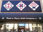 | “Corn & Beans, Farmer’s Daughter & Grape Basket” Field to Fabric Quilt Company, 907 Main, Winfield KS 67156 Carolyn Seeliger & Sally Ray Hung November 2014 This main street building, built in the early 1920’s, recently became home to The Field to Fabric Quilt Company business, owned by two farmer’s daughters. Their families have lived in the Winfield area for many years and both families raise cotton, corn, soybeans and other crops. The new business owners felt quilt blocks on the store front seemed the perfect way to highlight the business. |
 | “4-H Blocks and Stars” |
 | “Moving On” Roxy Callison, 1628 E 8th, Winfield KS 67156 This home, made of area limestone, was designed by Bob Kitch and Don Potter, The carport/garage and porch have been added by Kenny Day Construction. Roxy painted the quilt block on the chimney, viewed best from the parking lot at 8th and College. One must drive up close to see the “stitching” on the quilt. “Moving On” was inspired by the Flint Hills landscape and its effect upon Roxy’s struggle to work through grief after the death of her husband. |
 | “Bow-tie” |
 | “Sister’s Choice w/brand” |
 | “Chain Variation” Central High School, 700 N Main St, Burden KS 67019 Artists: FCCLA This barn quilt hangs on the Central High School wood shop and agriculture building. Central School district is a consolidated district serving the communities of Atlanta, Burden, Cambridge and Grenola. The quilt was painted by students in the organization “Future Consumer and Community Leaders of America” using school colors. |
 | “Tennessee Compass” Udall Community Building, 102 E 1st, Udall KS 67146 Artists: Udall Cooperettes Hung: 2015 The Community Building was originally built in 1950-1952 at the cost of $8,208.20. The only money borrowed was $500 from the Udall Bank on a no-interest note. The building was dedicated March 2, 1952, but was leveled by a devastating tornado May 25, 1955. The tornado took the lives of 76 people and flattened the town, also destroying the churches, city hall, school buildings and businesses. Only one house was left untouched. Two days later, temporary walls and a new roof was up and the 50 x 80 foot building was used as temporary headquarters for workers in the disaster area, and housed the telephone exchange, post office, insurance claims, clothing and other relief aid. After clean up was completed the materials for the temporary shelter were donated to the town to construct a new community building which reopened in 1957. The community center underwent a huge renovation project relying once again on donated labor and was rededicated in May 2014. GPS Coordinates: 37.38 7501, – 97.11 7033 |
 | “Star In A Star” |
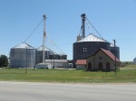
 | “Ohio Star” Kent & Pam Crain, 26129 101st Rd, Arkansas City KS 67005 Artists: Cowley County Tourism Alliance The Crain Farm has been in the family for 99 years. This building, built in 1971, is used for farm equipment storage and a shop. This barn was built primarily with repurposed materials from a Buick car dealership in Arkansas City. |
 | “Farmer’s Friend” |
 | “Lucky Star, From Here To There, & Airplane” “Old” Cambridge State Bank, 116 W Main, Cambridge KS 67023 The building once housed the Cambridge State Bank which incorporated in 1907 and has since closed. Like many banks of the time it was robbed numerous times. Local tale is that notorious gangsters Al Spencer and Pretty Boy Floyd robbed the bank in 1922 or 1923. Also see the local ranch brands burned into the wood walkway along the front of the building. The artist chose the Airplane pattern to honor the memory of her older brother. She recalls her mother and grandmother teaching her to quilt when she was ten. Her older brother also wanted to learn and chose the Airplane pattern for his. |
 | “Flag Heart” Robert & Sarah Long, 5496 252nd St, Arkansas City KS 67005 This farm has been in the Long Family for 40 years. The building displaying the barn quilt was built in 2014 as a storage building. The area where the house and building set was struck by a “down burst”/tornado in the early 1990’s, destroying the old buildings. All the buildings on the property have been erected since 2000. |
 | “Split Ohio Star” Silver Creek Rodeo Co., Matt Williams and Family 1519 6 US Hwy 166, Arkansas City KS 67006 Hung 2015 This barn quilt was won at a silent auction supporting their daughter’s music program and painted the school’s colors. It is displayed at the family’s prorodeo stock contracting business, Silver Creek Rodeo Company. GPS Coordinates: 37.077/96.892370 |
 | “America Star” Fleming Feed & Grain, 20325 112th Rd, Burden KS 67019 Artists: Central High School Art Dept. Hung: 2015 GPS Coordinates: 37.316248, – 96.801325 |
 | “Jobs Trouble Variation” Forgotten Item Market, Scotty & Sherrie Conklin, 411 N Main, Burden KS 67019 Artist: Deb Firebaugh, Cowley First Hung 2015 Forgotten Item Market opened in 2013 in a building previously occupied by the town’s barber and the local bar joint. Forgotten Item is a family operated business that offers groceries, produce, milk and dairy, cleaning items, frozen foods and almost any item that you may need in a hurry. The store is a service to the citizens of Burden and surrounding areas as the next closest full service grocery store is over 30 minutes away! Forgotten Item was awarded the “2015 Leader of the Year” award by Huck Boyd National Institute for Rural Development. GPS Coordinates: 37.315493 – 96.753518 |
 | “Dresden Plate” Grouse Valley Grill, 501 N. Highway K15, Dexter KS 67038 Artist: Deb Firebaugh & Kerri Falletti, Cowley First Hung: 2015 Operated since 2010 by Randy Waldeck and Wanda Jackson, Grouse Valley Grill is a small community diner that serves the community of Dexter, eastern Cowley County and surrounding areas. Famous for hand-pattied hamburgers, pizza and made from scratch breakfast items, it is well worth the drive to Dexter for a bite to eat. Open Mon-Sat 7-7. |
 | “Director’s Dream” Steve & Catheryn Joyce, 210 N. Walnut, Dexter KS 67038 Artist: Dexter High School students. Hung: 2015 Students at the local high school created barn quilt patterns as a class assignment then students volunteered to paint several barn quilts for the community, including this one. Mr. Joyce is a teacher at the school. |
 | “Whirling Star” Atlanta Community Building, 419 S Main, Atlanta KS 67008 Artist: Central High School students Hung: 2015 The Atlanta Community building was constructed in the late 1920’s as a theatre and could seat over 600 people. Silent movies were shown there through the 1930’s. The building is now a community center used for community events such as the Firemen’s Auxiliary Chicken Noodle Dinner and the annual Labor Day Festival. |
 | “Sunflowers” George & Joannie Reimer, 203 N Walnut, Dexter KS 67038 Artists: Dexter High School Students Hung: 2015 This barn quilt, viewable from Valley Ave, was a design project in Mrs. Reimer’s graphic arts class. Having resided in Dexter for 16 years, Joannie Reimer is the computer/business teacher and George is the JH/HS Special Education teacher. GPS Coordinates: 37.18 1123, – 96.71 7939 |
 | “Nancy’s Fan” Dave & Kerri Falletti, 11125 114th Dr, Winfield KS 67156 Artist: Kerri Falletti Hung: 2015 This barn quilt is viewable from the east side of 101st Rd. It is hung on a metal building that was constructed in 2010 for Kerri’s horses. GPS Coordinates: 37.31 4327, – 96.97 0222 |
 | “Country Star Flag” Cambridge Senior Center, 403 West Main, Cambridge KS 67023 Artists: Central High School Students Hung: 2015 This building was constructed in Cambridge in 1927 as District 15 Elementary School. Remnants of the high school, built in 1917, can be seen across the street. In 1963 the Cambridge school district consolidated with neighboring communities and the Central School District. GPS Coordinates: 37.319415, -96.667589 |
 | “Starburst” Dexter Community Rural Health Clinic, 204 N Main, Dexter KS 67038 Artists: Dexter High School Students Hung: 2015 Viewable from Valley Avenue, the Dexter Community Rural Health Clinic serves the healthcare needs of Dexter residents and the surrounding area. GPS coordinates: 37.18 0112, -96.71 5981 |
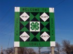
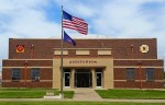
 | “Udall FFA” Udall FFA Chapter, S Main & S Clark, Udall KS 67146 Artists: Udall FFA Chapter Hung: 2015 At the Udall South Exit, intersection of S Main and S Clark/Cowley 3 the Udall FFA Chapter hung this block May 2015. The barn quilt shows appreciation to community members of their continued support of the FFA chapter. The Udall FFA chapter currently (May 2015) has 57 middle and high school members. This chapter reopened in the fall of 2012 and they wanted the opportunity to thank the community for their help and support of making their chapter successful. GPS Location: 37.382843, -97.115037 |
 | “Bethlehem Star” & “Nancy’s Fan” Dexter High School, 311 N Main, Dexter, KS 67038 Artists: Dexter High School Students Hung: 2015 The barn quilts are displayed on the USD 471 Dexter High School gymnasium, constructed in 1915. Since the construction of the new high school gym, this gym is now used as a practice gym and used for elementary PE. As a class project, high school students created barn quilt designs using the school colors of red and black and also the sports colors of gold and black. While the school has not consolidated, the sports program has consolidated with the Cedar Vale school district. The Cardinals is the school mascot and the Spartans is the sports mascot. Dexter is a small rural school with typically fewer then 50 students enrolled in high school. GPS Coordinates: 37.182 005, – 96.714 921 |
 | “Crown of Thorns” |
 | “Majestic Mountains” |
| “Sunflowers” Dexter Swimming Pool, 110 W School Street, Dexter KS 67038 |
 | “Sunflower & Bowties” |
 | “Arrowheads” |
 | “Connemara” |
 | “Star of Glory” |
 | “Tennessee Compass” Don and Patrice Williamson, 22549 62nd Rd., Burden KS 67019 Hung: 2015 GPS Coordinates: 37.38 8647, – 96.75 7148 |
 | “Carpenter’s Wheel” |
 | “Crows Beak” City of Dexter, Central Ave (across from City Park), Dexter KS 60738 Artist: Virginia Smith Hung: 2015 This pattern was chosen by Dexter resident Marlene Helsel, who teaches quilting at the Dexter High School. The building it is hung on is owned by the city and used for storage. GPS Coordinates: 37.17 9006, – 96.71 6548 |
 | “Balloons & Mni Barn Quilt Trail” |
 | “Aster” |
 | “Star Within A Star” |
 | “Liberty Star” |
 | “Navajo Patch” |
 | “Variations of Bear’s Paw, Greek Square, Cross & Crown and Nine Patch” |
 | “Bloomin’ Starflower” |
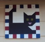 | “Cat Quilt Block” |
 | “Ohio State Variable” |
 | “Swinging Star” |
 | “American Star” |
 | “Criss Cross” |
 | “Bear Claw” |
 | “Sunflower” |
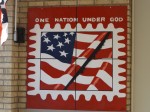
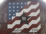 | “POW MIA Flag” |
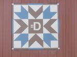 | “Big ‘D'” |
 | “Primary Star” |
 | “County Star” |
 | “The Stamp” |
 | “Cross and Thorns” |
 | “Rock Cross” |
 | “America” |
 | “Rising Star” |